Jun 2026
Hokkaido
|
Route
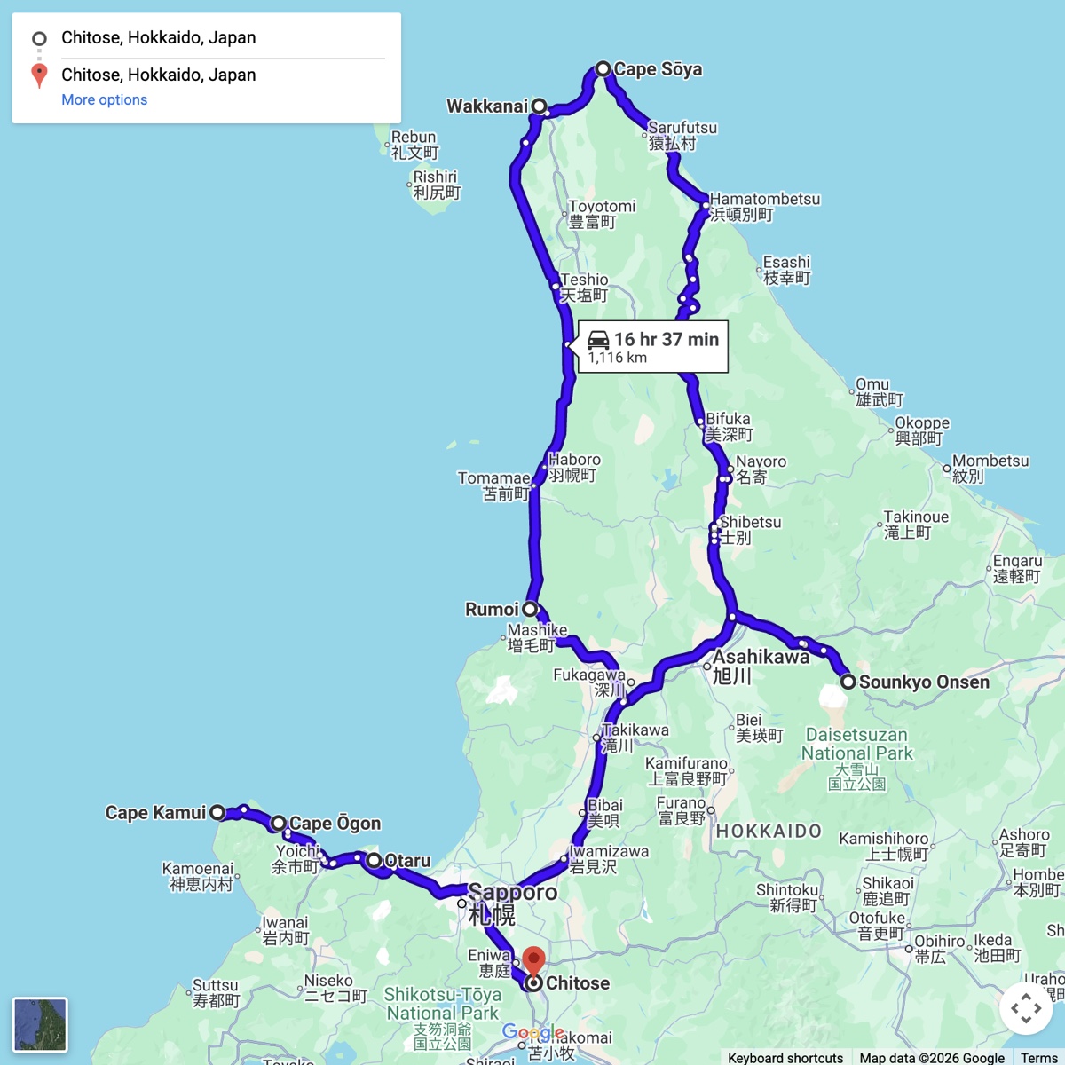
Chitose → Sounkyo Onsen → Nayoro → Bifuka → Hamatombetsu → Cape Soya → Wakkanai → Rumoi → Otaru → Yoichi → Furubira → Cape Shakotan → Cape Kamui → Chitose
Route Map
 Highlights
Cable car up into Daisetsuzan National Park at dawn.
Mikuni Pass, the Taushubetsu bridge at Lake Nukabira, and the submerged railway tracks at Lake Shikaribetsu.
Ryusei and Ginga waterfalls.
Cape Soya, the northernmost point in Japan.
The Ororon Line, with Mount Rishiri floating in the sea, and the moors and marshes of Sarobetsu.
A seaside onsen at Furubira, then the Shakotan blue at both capes.
An onsen dip almost every day.
Parks & Protected Areas
Daisetsuzan National Park
Highlights
Cable car up into Daisetsuzan National Park at dawn.
Mikuni Pass, the Taushubetsu bridge at Lake Nukabira, and the submerged railway tracks at Lake Shikaribetsu.
Ryusei and Ginga waterfalls.
Cape Soya, the northernmost point in Japan.
The Ororon Line, with Mount Rishiri floating in the sea, and the moors and marshes of Sarobetsu.
A seaside onsen at Furubira, then the Shakotan blue at both capes.
An onsen dip almost every day.
Parks & Protected Areas
Daisetsuzan National Park
Rishiri-Rebun-Sarobetsu NP (Ororon coast) Niseko-Shakotan-Otaru Quasi-NP Signature Roads Mikuni Pass Ororon Line, Wakkanai to Rumoi Shakotan Peninsula capes road |
Notes from the Ride
Hokkaido in early summer is a strange kind of empty. The roads are wide and well made and there is almost nobody on them, and the further north you go the more that becomes the point.
The plan fitted in a sentence: get to Cape Soya, the northernmost point in Japan, then follow the sea home. Five days, 1370 km, a bike picked up outside Chitose.
What the plan didn't account for was how much of it would be spent stopping. A cable car into Daisetsuzan at dawn. An arch bridge at Lake Nukabira that sinks and resurfaces with the reservoir. Railway tracks running into the water at Shikaribetsu. Waterfalls at dusk. Then, on the fourth day, the whole west coast at once — the Ororon Line with the sea on one side, the moors and marshes of Sarobetsu on the other, and Mount Rishiri floating offshore like something drawn in later.
And the onsen. One most evenings, sometimes two, always the first thing after the bike was parked. By the end it had stopped being a reward and become the rhythm: ride, arrive, sit in very hot water, eat, sleep, ride.
Cape Soya itself takes about ten minutes. Everything either side of it took five days, which is roughly the correct ratio.
|